Severe convective weather functions as a high-velocity disruptor of physical and economic infrastructure, characterized by a specific collision of thermodynamic potential and kinetic triggers. While standard reporting focuses on the emotional toll of "millions under threat," a structural analysis reveals that the true risk profile is defined by the intersection of three specific variables: convective available potential energy (CAPE), vertical wind shear, and population density vulnerability. When these factors align, the result is not just "bad weather" but a systemic failure of local safety margins.
The Thermodynamic Engine of Supercell Formation
The primary driver of severe weather is the conversion of potential energy into kinetic force. This process begins with a steep lapse rate—the rate at which atmospheric temperature decreases with altitude. When warm, moist air at the surface is trapped beneath a layer of cooler, dry air, the atmosphere becomes "unstable."
The Three Pillars of Atmospheric Destabilization
- Moisture Advection: The low-level transport of high-dewpoint air, typically from a maritime source like the Gulf of Mexico, provides the latent heat necessary for cloud formation and storm sustenance.
- Forced Ascent: Without a trigger, an unstable atmosphere remains stagnant. Triggers take the form of drylines (density boundaries between moist and dry air), cold fronts, or orographic lifting (terrain-driven ascent).
- The Cap (Inversion): A layer of warm air aloft acts as a lid, preventing premature, weak convection. This "cap" allows energy to build at the surface until it is breached, leading to explosive storm development rather than a slow release of energy.
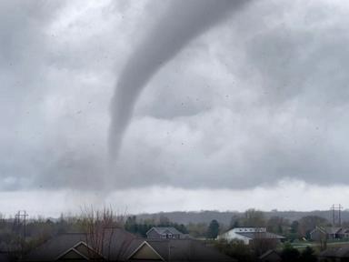
The severity of a tornado or high-wind event is mathematically linked to the magnitude of these variables. CAPE, measured in joules per kilogram ($J/kg$), quantifies the buoyancy of an air parcel. Values exceeding $2,500\ J/kg$ indicate an environment capable of supporting violent updrafts. However, CAPE alone does not produce tornadoes; it produces vertical velocity. The rotation required for tornadic activity is supplied by Kinematic Shear.
The Kinematic Constraint: Wind Shear and Helicity
Vertical wind shear—the change in wind speed and direction with height—is the mechanical force that tilts and rotates a storm's updraft. Without shear, a storm’s precipitation falls directly back into its updraft, effectively suffocating the system.
The Mesocyclone Production Function
When shear is present, the storm develops a rotating core known as a mesocyclone. This rotation is quantified through Storm-Relative Helicity (SRH). High SRH values in the lowest 1 kilometer of the atmosphere are the most reliable predictors of tornadic potential.
The relationship between buoyancy and shear creates a specific "Goldilocks zone." If shear is too weak, the storm remains disorganized. If shear is too strong relative to the buoyancy, it can "shred" the updraft before it matures. The most lethal storms—long-track supercells—occur when these forces are in equilibrium, allowing the storm to maintain a steady state of energy intake and exhaust for hundreds of miles.
The Cost Function of Infrastructure Vulnerability
The threat to "millions" is a function of the Built Environment Exposure (BEE). We must categorize the risk not just by the storm's intensity, but by the structural integrity of the geography it traverses.
Vulnerability Stratification
- Type I: High-Density Urban Cores: Characterized by steel-frame construction. While largely resistant to total structural failure from wind, the risk here is concentrated in glass curtain walls and projectile debris. The economic cost is driven by business interruption and telecommunications failure.
- Type II: Suburban Residential: Dominated by wood-frame housing. These structures often lack adequate "load path" continuity (connecting the roof to the foundation). An EF-3 tornado ($136-165\ mph$) typically results in near-total loss for these assets.
- Type III: Critical Infrastructure Nodes: Power substations, water treatment plants, and logistics hubs. A single strike on a high-voltage transmission line can trigger a cascading failure across a regional grid, regardless of whether the storm hits a population center.
The "threat" reported in mainstream media is often an oversimplification of the Probability of Detection (POD) vs. the False Alarm Ratio (FAR). When the National Weather Service issues a "Watch," they are identifying a region where the thermodynamic variables are present. A "Warning" indicates that the kinetic event is occurring or imminent. The gap between these two stages is where the highest mortality occurs due to "warning fatigue," a psychological bottleneck where the public discounts risk after multiple false alarms.
The Logistics of the Lead Time Bottleneck
The primary metric for success in severe weather management is Lead Time. Over the last three decades, average lead time for tornado warnings has increased from near-zero to approximately 13 minutes. However, we have reached a plateau defined by the physics of radar technology.
Current S-band Doppler radars are limited by the Earth's curvature. As the radar beam travels away from the station, it gains altitude. By the time a beam reaches a storm 60 miles away, it is scanning thousands of feet above the ground. It cannot "see" what is happening at the surface where people live.
The Technological Pivot: Phased Array and Gap-Filling
To break the 15-minute lead-time barrier, the strategy must shift from mechanical radar dishes to Multifunction Phased Array Radar (MPAR). Unlike traditional dishes that rotate, MPAR uses electronic scanning to provide updates every few seconds rather than every few minutes.
Furthermore, the deployment of "gap-filling" X-band radars—smaller, low-altitude units—allows meteorologists to observe the "boundary layer" (the lowest 3,000 feet of the atmosphere). This is where the final stage of tornadogenesis occurs. Without data from this layer, the distinction between a rotating cloud and a ground-contact tornado remains an educated guess based on the presence of a "debris ball" on radar—which signifies that damage has already begun.
Economic and Actuarial Implications of Shifted Storm Tracks
There is a measurable eastward shift in the core frequency of severe weather, moving from the traditional "Tornado Alley" (Great Plains) into the "Dixie Alley" (Southeast US). This transition increases the casualty potential significantly due to three factors:
- Forestry and Visibility: In the Plains, storms are often visible from miles away. In the Southeast, trees and hills obscure the horizon, making "visual confirmation" impossible for the public.
- Nocturnal Cycles: Atmospheric dynamics in the Southeast frequently lead to nighttime tornadoes. Mortality rates for nocturnal events are nearly double those of daytime events because the primary alert mechanism—vision—is neutralized, and residents are often asleep.
- Housing Stock: The Southeast has a higher concentration of manufactured homes, which are statistically the most dangerous locations during a wind event.
This geographic shift necessitates a massive reallocation of capital for hardening infrastructure. It is no longer sufficient to build to standard code in regions like Northern Alabama or Western Tennessee; the "new normal" requires a shift toward storm-shelter integration in all multi-family residential developments.
The Strategic Play for Resilience
Organizations and municipalities must move beyond reactive postures. The following framework should be implemented to mitigate the systemic risk of severe weather events:
- Asset Hardening via Aerodynamic Retrofitting: Priority should be placed on the roof-to-wall and wall-to-foundation connections in critical facilities. Use of hurricane clips and reinforced garage doors reduces the probability of structural "unzipping" during high-wind events.
- Redundant Communication Loops: Relying on cellular networks is a failure point. Integrated systems using satellite-linked emergency overrides ensure that "Millions under threat" are not just informed, but instructed.
- Real-Time Data Integration: Private sector entities should integrate NWS API feeds directly into their operational workflows, triggering automatic shutdowns of hazardous machinery or gas lines when a storm's "velocity couplet" (a radar signature of rotation) enters a pre-defined geofence.
The evolution of severe weather management will not come from better adjectives in headlines, but from the granular application of fluid dynamics and structural engineering to the warning process. The focus must remain on the physics of the atmosphere and the fragility of the built environment.